|
This is translated by Google translate. It might not be accurate but will give general picture of the old time. Visby inner city inventory
The barrel binder 3 Description The Tunnbindaren block is rectangular in shape and located in the eastern part of Visby's inner city. Tunnbindaregatan runs along the northwestern border, Repslagaregränd along the northeast, Södra Murgatan along the southeast and Blockgränd runs along the southwest border. Prior to the current property division, the block belonged to Klinteroten's third block with plot numbers 49½, 55-61 and 67-72. The block was on the 1697 map included as arable land, except for three plots in the eastern part along Södra Murgatan with, from north to south, numbers 80, 60 and 166, respectively. there are masonry remains from two medieval stone buildings in the existing residential building. Masonry after medieval houses has also been found on Tunnbindaren 1 and in the street west of the current Tunnbindaren 12. The block was divided into plots during the 18th century, most of it with the characteristic, elongated shape for Klinten. In principle, the plot division has been preserved, with the exception that plots 59-60, in the south-eastern part, have been merged to become the current Tunnbindaren 15. According to the house classification in 1785, the buildings consisted of residential houses and stables in parcels. During the 18th century and until the middle of the 20th century, the neighborhood was mainly inhabited by workers, sailors and craftsmen, and to some extent also by officials and merchants. The neighborhood is today divided into twelve properties. On several of them, the older wooden houses remain, but most have been modernized during the 20th century. Around the turn of the century in 1900, a small number of new larger stone buildings were built in the neighborhood. Some of these buildings house association premises, but most of the properties are privately owned.
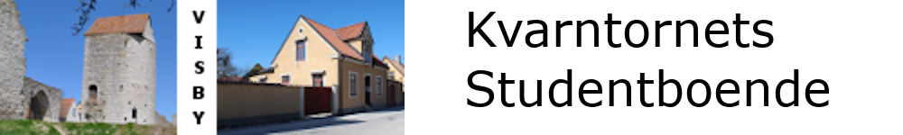
The property Tunnbindaren 3 is located in the eastern part of the block along Södra Murgatan. In 1697, most of the block's area consisted of arable land. This property was then part of two large plots, numbers 60 and 80, and the arable land in between. The property was given its current demarcation when the block was regulated during the latter part of the 18th century and was named, before the current property division, plot number 56 in Klinteroten's third block. According to the house classification in 1785, the building then consisted of a wooden house and stable under a wooden roof. The buildings were demolished before 1883. Shortly afterwards, before 1890, the oldest part of the current main building was built, a simpler bourgeois house with a plastered brick frame. The building is located, with the long side along and the main entrance towards, Södra Murgatan. Around the turn of the century in 1900, the paneled outbuilding was added, which is located along the northern plot boundary. The buildings today house office space and archives and storage. North of the main building, and in life with it, there is an approximately four meter high brick wall that is plastered and brick covered. The wall is broken up towards the street by a large brown-painted driveway. The gate, which was added in the 1930s, has a semicircular top, horizontal tongue-and-groove panel and is equipped with a pedestrian gate in the middle. In the courtyard south of the main building there is a lower wall with a similar appearance that was built in the 1980s. The farm is paved with asphalt and lacks plantings. The property's buildings and framing have externally their style-historical features largely intact and connect well to the street space. The property therefore has a cultural-historical value and an environmental value in the area. Buildings: 2 Farm occupancy Archaeological investigations Main building
Construction start: 1890
|